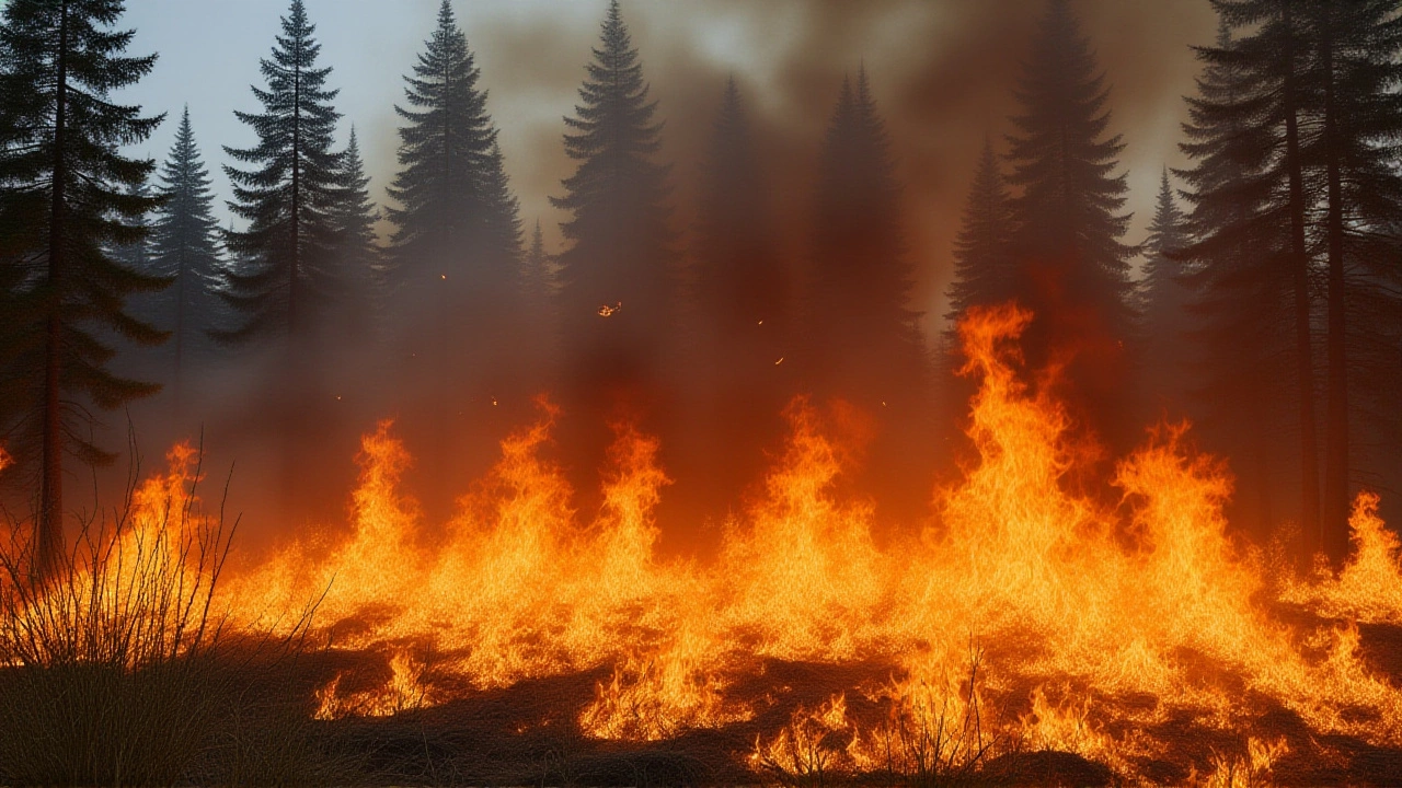
When Summit Lake wildfire erupted across 2,125 hectares of dry forest, the Alaska Highway between the Highway 77 junction and Toad River was forced to shut its doors, stranding travelers and rattling supply chains west of Fort Nelson on June 2, 2025.
How the blaze unfolded
The fire was first spotted on May 28, 2025, about 10 km northeast of Summit Lake, in the Northern Rockies of northeastern British Columbia. The BC Wildfire Service, which classifies the incident as an "incident of note," quickly dispatched a helicopter team and a 47‑person incident management crew. By June 2, the flames had leapt to more than 6,000 acres – roughly 2,428 hectares – and were still burning out of control.
According to the agency’s spokesperson, Mike Ladue, the fire likely ignited from a lightning strike, although some local observers have hinted at possible human involvement. Either way, the combination of multi‑year drought and gusty winds turned a modest spark into a fast‑moving inferno.
Evacuation alert and highway shutdown
At 5:40 p.m. PT on June 2, the Northern Rockies Regional Municipality (NRRM) issued an evacuation alert covering a ribbon of properties along the highway between the Steamboat Mountain brake check (mile 333, kilometre 536) and a stretch of GPS coordinates that pinpoint the Tetsa River area. The alert did not immediately become a full evacuation order, but residents were told to pack essentials and be ready to leave on short notice.
DriveBC’s real‑time map reflected the closure, noting that there is no detour available. The Alaska Highway briefly reopened to single‑lane traffic around 5:00 p.m. the same day, only to be shut again later that evening as fire crews reported renewed flare‑ups between Grouse Trail and Toad River. A second, temporary closure was logged around noon on June 3, cementing the road’s status as a critical chokepoint.
Impact on communities and commerce
For the handful of towns that rely on the Alaska Highway as a lifeline – including Fort Nelson, Dawson Creek and the remote communities of the Yukon and Alaska – the shutdown is more than an inconvenience. Trucking firms have reported delays of up to eight hours, and the price of fuel in local service stations spiked by roughly 12 % as supply chains scramble for alternative routes.
Tourists heading to the popular Stone Mountain Provincial Park were caught off‑guard, with several campsites reporting full bookings for alternative sites. "We had families on the road for three days, only to be told the highway was closed again," said a local owner of a fuel stop near the Steamboat Mountain checkpoint. The sentiment echoed across social‑media feeds, where the hashtag #SummitLakeFire trended in the region.
Response from fire officials and experts
The BC Wildfire Service’s incident management team, bolstered by two aerial tankers, continues to employ a "contain‑where‑possible" strategy, focusing on protecting structures rather than pursuing a full perimeter containment – a decision shaped by the rugged terrain and limited ground access.
Climate researcher Dr. Elena Ramos of the University of British Columbia warned that such fires are becoming the new normal. "We've seen a 30 % rise in extreme fire weather days over the past decade in the Northern Rockies," she told CBC Radio. "Drought indices are at historic lows, which means any ignition source, be it lightning or a stray spark, can generate a fast‑moving blaze like the Summit Lake fire."
Historical context: fires in the Northern Rockies
The region has a storied fire history. In 2015, the McBride Complex burned over 61,000 ha, forcing a three‑week closure of the same highway segment. More recently, the 2022 Tumbler Ridge fire burned 12,300 ha and prompted the first ever permanent evacuation order for the town of Chetwynd. Compared with those events, the current blaze is smaller in acreage but more disruptive because it hits a critical transportation corridor during a busy summer travel period.
Back in 2003, the BC government introduced the "FireSmart" program to encourage residents to clear vegetation within 30 m of structures. While the program has reduced structural losses, it does little to stem the spread of wildfire across vast, remote boreal forests – the very landscape the Summit Lake fire is traversing.
What lies ahead
Weather forecasts from Environment Canada predict a dry, windy spell moving through the Northern Rockies between June 5 and June 9. If winds pick up to the projected 30–35 km/h, fire crews fear the blaze could leap over natural firebreaks and threaten additional sections of the highway.
Meanwhile, NRRM officials are urging residents to keep their evacuation kits updated and to monitor the BC Wildfire Service’s mobile app for real‑time alerts. "We’re prepared to issue an order at any moment," said a municipal spokesperson, "but we hope the situation stabilizes before that becomes necessary."
Broader implications for cross‑border travel
The Alaska Highway is more than a provincial road; it’s a conduit for trade between Canada, the United States, and the Yukon Territory. A prolonged closure could force freight carriers to reroute through the Haida Gwaii ferry system, adding an estimated 500 km to trips and feeding into higher shipping costs for goods ranging from food to construction materials.
U.S. Customs officials in Skagway, Alaska, have already reported a backlog of commercial trucks awaiting clearance, a ripple effect that underscores how a single wildfire can reverberate across international borders.
Key takeaways
- Summit Lake wildfire ignited on May 28, 2025 and has scorched over 2,125 ha.
- The Alaska Highway closure began at 5:40 p.m. PT on June 2, 2025 and remains in effect with no detour.
- NRRM issued an evacuation alert covering critical stretches of the highway and adjacent properties.
- 47 firefighters, two helicopters, and aerial tankers are currently battling the blaze.
- Dry, windy conditions forecasted for early June could exacerbate the fire’s spread.
Frequently Asked Questions
What caused the Summit Lake wildfire?
Officials with the BC Wildfire Service believe a lightning strike ignited the fire, though some local reports suggest possible human activity. Investigations are ongoing.
Which communities are most affected by the highway closure?
Fort Nelson, Dawson Creek, and several remote Yukon and Alaska communities rely on the Alaska Highway for supplies and travel. Commercial trucking routes have been delayed, and local fuel stations report higher prices.
When is the highway expected to reopen?
There is no definitive timeline. Officials say the road will remain closed until fire crews achieve sufficient containment and weather conditions improve, likely beyond early June.
How can travelers stay updated on the situation?
Drivers should monitor the DriveBC website, download the BC Wildfire Service app, and follow local radio broadcasts for the latest alerts and road status.
What does this fire mean for future wildfire preparedness in the region?
Experts say the event highlights the need for expanded fire‑break infrastructure and better cross‑border coordination. Climate trends suggest similar high‑risk fire seasons are likely in the coming decade.